

![English [GB]](../../../language/en_GB/en_GB.jpg "English [GB]")
![English [US]](../../../language/en_US/en_US.jpg "English [US]")
![Nederlands [NL]](../../../language/nl_NL/nl_NL.jpg "Nederlands [NL]")
)
)
)
)
)
)
)
)
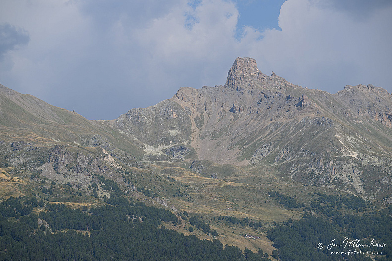
La Maya above Val d’Hérens
Camera brand and type used to take photo
 NIKON Z 9
Lens used
NIKON Z 9
Lens used
 NIKKOR Z 100-400mm f/4.5-5.6 VR S @ 220 mm
NIKON Z 9
Lens used
NIKKOR Z 100-400mm f/4.5-5.6 VR S @ 220 mm
Aperture used
 f/8.0
Exposure used
f/8.0
Exposure used
 1/250 s
Exposure compensation applied
1/250 s
Exposure compensation applied
 0.0 EV
ISO used
0.0 EV
ISO used
 64
64
f/8.0
Exposure used
1/250 s
Exposure compensation applied
0.0 EV
ISO used
64
Copyright © 2026 Jan-Willem Kruse (www.fotokruse.eu).
All rights reserved. For consideration only, no reproduction without prior permission.
All rights reserved. For consideration only, no reproduction without prior permission.
Photo Info
fgk-20260813-Z9-0921a-la-maya-val-herens-les-masses-valais-swiss-alps.jpg
2560*1707
(1090 KB)
118x visited
Description
Headline
La Maya above Val d’Hérens
Caption
La Maya rises above Val d’Hérens with its distinctive gneiss summit tower clearly outlined against the sky, viewed from Les Masses.
Image Alt text
Telephoto view of La Maya with its distinctive narrow rock summit tower above alpine slopes.
Event
-
Keywords
Capture info
(IPTC Instructions)
(IPTC Instructions)
Metadata generated by ChatGPT GPT-5.6 Sol at 16-Aug-'26 19:01 with AI Photo Metadata Grabber ChatGPT v1.23.2 (99% confidence). Location Created GPS based (98% confidence). Location Shown estimated (99% confidence). GPS position source GPS (100% confidence
Location
Location
- - - -
Altitude
1700 meter
Properties
Original filename
Z9-0921a.jpg
Taken on
13-Aug-2026 16:48:40
Digital Source
Digital camera
Posted first on
16-Aug-2026 19:32:18
Update posted on
16-Aug-2026 19:32:19
Rating/label
Adobe Lightroom
Adobe Lightroom
Label and rating as set in Adobe Lightroom
no rating
Rating score
no rating
Update rating
Rate this photo
Copyright
Credit line
Copyright © 2026 Jan-Willem Kruse (www.fotokruse.eu)
Copyright
-
Copyright Notice
-
Photographer
Jan-Willem Kruse
Other Info
Related albums
Job identifier
-
0 comments